Showing posts with label Hiking trails Ontario. Show all posts

Saturday, 28 December 2013

Deer in Dundas Valley Ontario

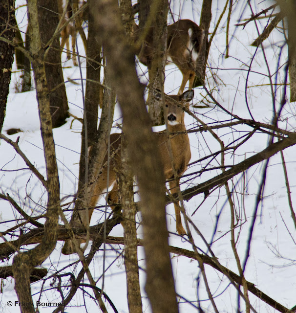
The most incredible and unexpected brushes with nature will present themselves at times that are less than perfect. Mother Nature presented herself while Margaret and I were taking a drive through the Dundas Valley.  I believe the six beautiful and healthy deer were moving through the valley looking for a safe place to stay for the evening.

 
Outdoor Adventurers
Deer in the Dundas Valley


I grabbed my camera and took off down a trail that would intersect the direction that they were headed. Feeling the rush come from seeing beautiful wild animals free has always been something I have found indescribable.

I hope you enjoy the photographs that I was able to capture. It is still possible to see wild deer and turkeys near suburban areas if you are in the right place at the right time.

Outdoor Adventurers
The herd of deer watching me get closer

Outdoor Adventurers
Most deer have a comfort zone that they monitor

Outdoor Adventurers
After the initial contact, the herd became comfortable with my presence

Outdoor Adventurers
A quick look back to see if I'm still there

Outdoor Adventurers
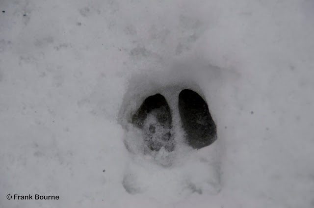
Deer tracks

Outdoor Adventurers

Sunday, 17 March 2013

Tiffany Falls Late Winter - Hamilton Ontario

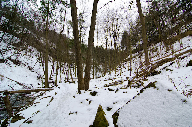
During the winter there is so much to do outside. Going for a winter hike or checking out a favourite outdoor spot could be just the thing to stay active.

Tiffany Falls in Hamilton Ontario is one of those spots. A fantastic place to visit in all season, even late winter. Last year in the Fall, Margaret and I hiked to Tiffany Falls Conservation Area and experienced the beautiful area first hand. You can check out my blog post from the Fall here.

Outdoor Adventurers
Entrance to Tiffany Falls Conservation Area Trail


Outdoor Adventurers
Great Signage for the Side Trail


Outdoor Adventurers
Well maintained bridges help get to the Falls


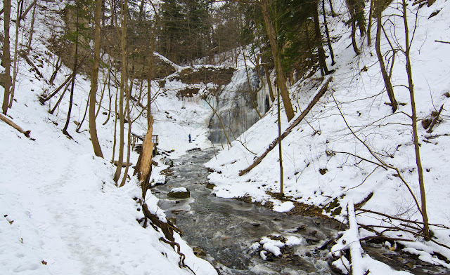
I was curious what it would look like during the late winter. The particular weekend we hiked to the falls we were surprised to see ice climbers practicing rappelling and climbing the ice that surrounded the cascade. 


Outdoor Adventurers
A little bit of green from the white pine


Outdoor Adventurers
Melt water


Outdoor Adventurers
Bridge #1


Outdoor Adventurers
The Canyon


Outdoor Adventurers
Wide angle photo of the Niagara Escarpment


Outdoor Adventurers
Looking up to the edge of the Escarpment


Outdoor Adventurers
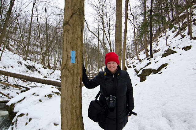
Margaret getting cold on the trail


Outdoor Adventurers
Some colour left over from last year

Ourdoor Adventurers
Mission Accomplished - reached the Falls


Outdoor Adventurers
Ice Climber


Outdoor Adventurers
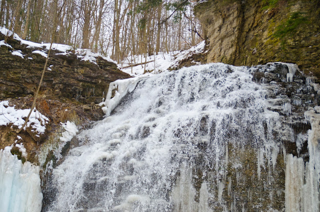
Tiffany Falls

Outdoor Adventurers
Ice climber getting climbing gear ready


Outdoor Adventurers
Ice climbers at the bottom of Tiffany Falls

Outdoor Adventurers
Tiffany Falls

   
There are so many activities outside that can be done in the Hamilton Area. From the  Dundas Valley Conservation Area close by,  to the Bruce Trail, and many more waterfalls to explore in the local area.

Check out some of the links below for more great information and photos of the Falls.

Suburban Tourist

Dundas Valley Conservation Area 
Waterfalls of Ontario
Hamilton Conservation Authority
Bruce Trail

Tourism Hamilton


Coordinates:  43° 14’ 22” N     79° 57’ 31” W         
                      UTM  17N 584553.13 E     4787932.69 N


Sunday, 24 February 2013

Exploring Mono Township - Mono Ontario

Each weekend Margaret and I decide to explore a new area of Ontario. This particular weekend it was Mono Township. Located about 40 minutes north of Mississauga and Brampton, you will find yourself in the middle of the Hills and Headwaters area of southern Ontario.

Outdoor Adventurers
Bruce Trail running through Mono Cliffs Provincial Park

Outdoor Adventurers
Dog prints in the snow

There are many areas the see and explore while in Mono. There are great hiking trails at the Mono Cliffs Provincial Park and the Bruce Trail runs through the park. If you want to go for a leisurely drive and explore the local area, you will be surprised by the beautiful scenery.


Outdoor Adventurers
Interesting shot between two birch trees

Outdoor Adventurers
Margaret on the Bruce Trail at Mono Cliffs Provincial Park

Outdoor Adventurers
Ontario hardwood forest in the winter


 A little to the south of Mono Centre, is the Hockley Valley. Very picturesque and really worth the drive in all four seasons.


We continued further north and checked out Boyne Valley Provincial Park. The area has fantastic topography and many hiking trails to explore. Along the way, stop at Ponton Mills. The remains of an old grist mill stands along the Boyne River. It was built in this location in 1896 by George H. Shepherd and operated until the early 1900s.


Outdoor Adventurers
Ponton Mills

Outdoor Adventurers
Curvy turns and rolling topography

Check out these other sites for more information:


Coordinates:

UTM 17N  5748084874147 N

Saturday, 8 September 2012

Colpoys Bay - Wiarton Ontario


Colpoys Bay is located on Georgian Bay, Ontario, Canada.  The Bay is named after Sir John Colpoy who was an Admiral in the British Navy during the early 1800s. With its limestone cliffs rising on either side of the bay, the Niagara Escarpment reveals itself. 

 
Colpoys Bay - Looking North


Niagara Escarpment Limestone Cliffs

 
 The remarkably clear blue waters of Georgian Bay are among the clearest in the Great Lakes with visibility reaching up to 20 meters. There are three islands at the entrance to Colpoys Bay – Griffith Island, Hay Island and Whitecloud Island.


Sailing to Whitecloud Island


Griffith Island is home to Griffiths Island Lighthouse. It is one of six Imperial Towers that were constructed around 1959. Commissioned in 1855 by the Board of Works who contracted a builder from Thorold, Ontario, this plan was to have eleven lighthouses and dwellings which would see the lighting of Lake Huron and Georgian Bay for shipping. 

White Cloud is larger than nearby Griffith Island, and has a well-protected harbour in Kidd Bay. Anchorage in the bay is popular with local sailors. Land on the island is privately owned, mostly wooded.


Super clear water in Colpoys Bay


Colpoys Bay with Whitecloud and Griffith Islands in distance
 
Limestone beach


Divers getting ready for some time under the waves

 
Chicory (Cichorium intybus)


Salmon Fishing - during the Salmon Derby
 
For hikers, the  Bruce Trail runs right through this area on its way north to Tobermory or south to Owen Sound

There are several Bruce County Conservation Areas that are located close by.  On our trip, we visited Colpoys Lookout Conservation Area and the Bruce’s Caves Conservation Area. I highly recommend checking this area out.


Check out these other sites for more information:


Colpoys Lookout Conservation Area   -  UTM  17N  498292 E  4960802 N

Bruce’s Caves Conservation Area   -  UTM  17N  494064 E  4957404 N